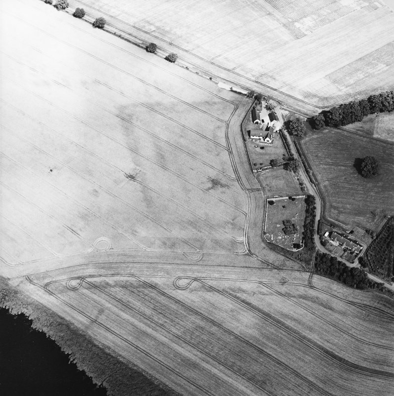
Just found what looks like a new Roman Encampment at Easter Rhynd between the Tay and River Earn. The camp is about 440m N-S and over 400m W-E. (There is no mention on Canmore). The aerial photo shows a single line with a very clear curved NW corner and part of the SW corner. This is very characteristic, as is the size and the location is also similar to other sites being in the fork of two rivers. It is also 1km NW along the Tay from the legionary fort of Carpow and another temporary encampment there.
This seem likely to be associated with the linear features at Easter Rhynd:
Given all the evidence it seems likely this is another to add to the 249 temporary camps already listed on Canmore.
The only reason for doubt, is that there is some indication of lines joining the northern "ditch". So, the possibility of a drainage ditch, which for some reason was curved cannot yet be ruled out.